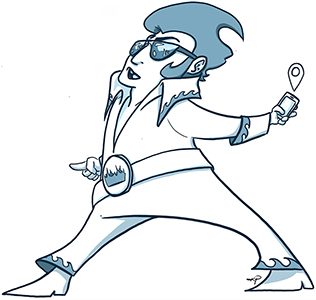
About 300 volunteers walked the high tide lines of coastal Virginia on Sunday Oct. 27, marking the third successful year for our Catch the King flood-mapping event.
Our hearty volunteers gathered more than 36,000 GPS data measurements of one of the coastal area’s autumn king tides. They’re really making a difference as we try to get a better handle on tidal flooding and improve flood forecast models.
Click here to read our news release about Catch the King 2019 and what’s coming next. Click here for a Daily Press wrapup. And click here for a data map for this year’s event.
Whether you’re a veteran tide mapper or a newcomer, we welcome you aboard as Catch the King moves into year-round flood tide tracking. Join us through the “SIGN ME UP!” links below. And if your company or membership organization is interested in doing its own tide-tracking, teambuilding event in conjunction with Catch the King, email us. We’d be happy to work with you.
Ready to help? Sign up to be a (Volunteer) King Tide Mapper, King Tide Captain, or Tide Watcher.
Use the app to drop GPS pins the day of the high tide.
In this role, you’ll use a phone app to drop GPS pins during the high tide Oct. 27. Before then, we’ll need you to go through training with the app. And you’ll be assigned to a Tide Captain who’ll help you choose a mapping location on the big day. That’ll keep us from having too many volunteers mapping the same location.
Perform mapping duties and manage a small team.
Every big project needs leaders, and here’s your chance to step up. Tide Captains lead small groups of mappers, helping to make sure they’re trained in the SeaLevelRise app and working with our Volunteer Coordinator to choose mapping areas. Captains are encouraged to host practice mappings of their own.
Document flooding at trouble spots along the shore.
We want as many people as possible on Oct. 27. But if you can’t get out that day, you still can help. Sign up as a Tide Watcher, and we’ll help you learn how to record flooding trouble spots throughout the year. It’ll help give us a better handle on where the risks are and might help your neighborhood get action on a pressing problem.
Ira Flatow, the coolest science dude on public radio, featured Catch the King on his May 17 broadcast. Take a listen as our chief science liaison, Derek Loftis of the Virginia Institute of Marine Science, talks about the project and tide tracking and forecasting.
Just in time for Earth Day 2019, Guinness World Records Ltd. has officially certified Catch the King as the world’s largest environmental survey. Guinness took the turnout from our debut event on Nov. 5, 2017, when 722 of you volunteered to help us measure the morning high tide. You collected a record-setting 59,718 data points. Thank you for putting us on the global map!
Hundreds more of you mapped again in 2018 along with lots of other first-time volunteers and many students from science classrooms throughout Hampton Roads.
Now, in year 3, we’re gearing up for even-bigger things. We’d like to beat our 2017 record and build momentum toward 1,000 volunteers in 2020. We also welcome you to join one of our newly forming year-round mapping teams.
In the meantime, mark your calendar for the morning of Oct. 27, 2019. That’s this year’s big mapping day. You’ll be hearing more from us in the weeks and months ahead about how you can contribute to our world-renowned tide-mapping initiative.
Your contribution to this innovative crowdsourcing initiative will help identify potential trouble spots for flooding throughout the region and aid scientists striving to more accurately predict flooding as sea levels rise.
Thanks again and keep mapping!
Create an account and begin tracking the tides in any coastal region, not just Virginia.
Download on iOS | Download on Android
Check out our Q&A on sea level rise and tidal flooding and see reports on past Catch the King data collections. Click here
Read all the latest news on Catch the King. Click here
You can find us on Facebook and Instagram and even join our Facebook group. Click here